


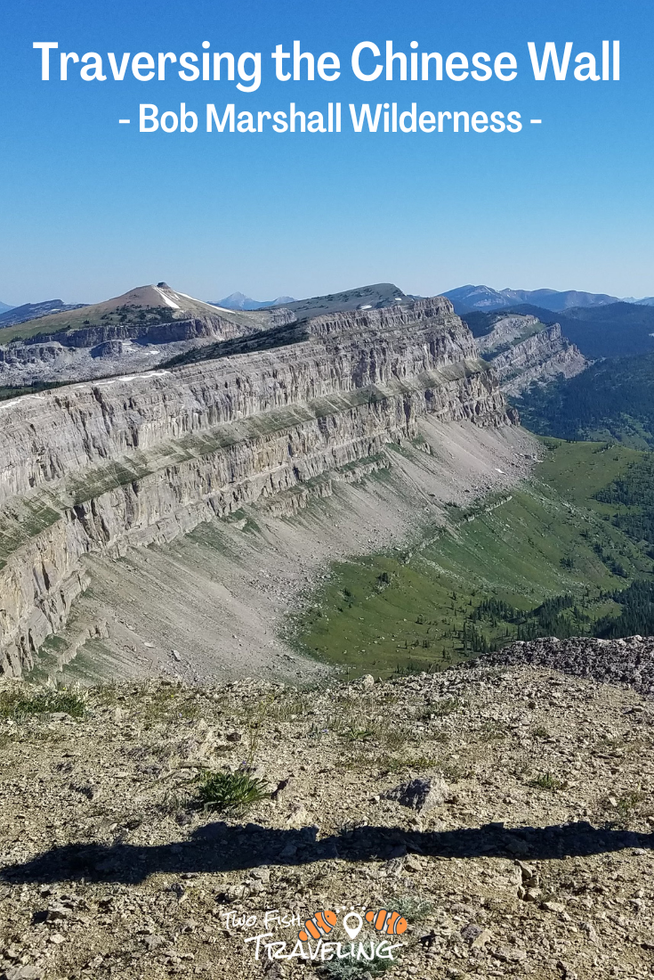
From July 21 – July 26, 2022, Sarah and I hiked the Top of the Chinese Wall in the Bob Marshall Wilderness. We started at Benchmark Trailhead, traversed the Wall from south to north, and finished at South Fork Trailhead after crossing Headquarters Pass. We made some navigation errors. This guide should help you do better.
There are lots of trail maps, so I won’t go into a ton of detail except when leaving the trail to traverse the Wall.
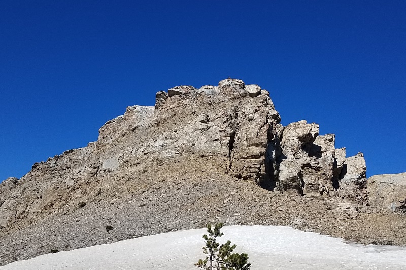
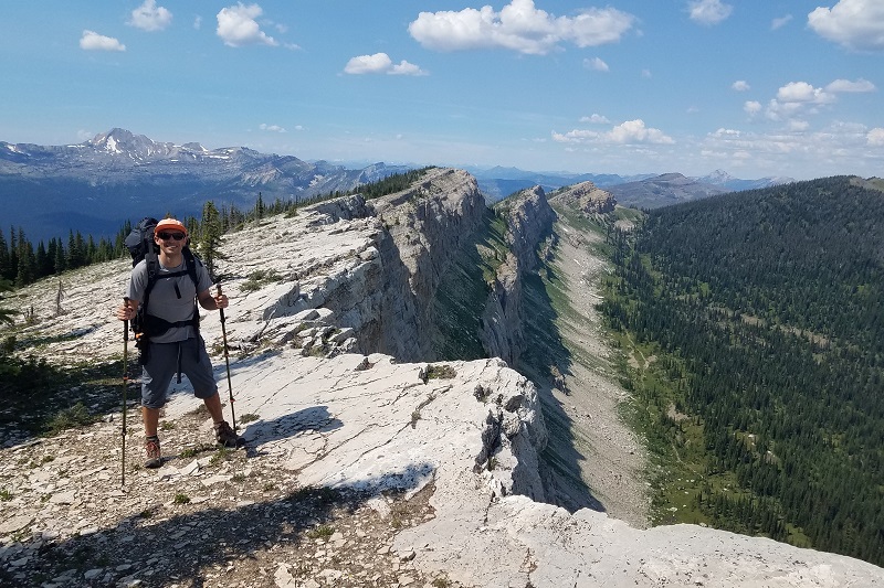
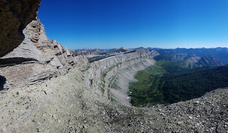 View from the ledge below Haystack Mountain
Things to consider:
Water and Weather
There are only a couple of places to get water on top of the Wall. Plan your water strategically. Each person should carry about a gallon of capacity.
A couple of years earlier, we hiked to the south end of the Wall in the first week of July after a few days of rain. The river crossing north of Indian Point was barely passable. Crossing in June may have been impossible.
On top of the Wall, the cliffs and scrambling could be dangerous in the rain. We didn’t see another person during our two days up top. It would be a scary place to injure yourself.
Navigating the trails
The Bob Marshall Wilderness is full of well-maintained trails. Distances are long and we saw more people on horses than on foot. There is a lot of horse poop.
The maps we used for this trip are from Cairn Cartographics. They are produced by a Missoula couple. Generally, we love their waterproof/tearproof trail maps, but annoyingly the Chinese Wall runs alongside the edge of the South Map and then crosses onto the North Map, requiring me to flip back and forth.
Bears
We saw one grizzly and two black bears. The grizzly didn’t react to us. The black bears ran off immediately. We saw grizzly scat on the edge of the Wall several times, possibly marking the natural border of their territory. We hung our food each night, which was challenging because the trees on top of the Wall were pretty scraggly. We each carried bear spray.
 Sarah posing with bear scat on the edge of the Wall
Day 1: Benchmark to Indian Point (~10.5 miles)
The first day is fully on a trail with only a minor elevation gain. A forest fire cleared a good section of the hike, so you’re not totally in the deep forest. There are some open fields and streams for camping around Indian Point. You could also drop down to the river and camp in a couple of places past Indian Point. There are a bunch of well-used campsites near the river crossing a mile after Indian Point, but they are muddy, buggy, and in the trees.
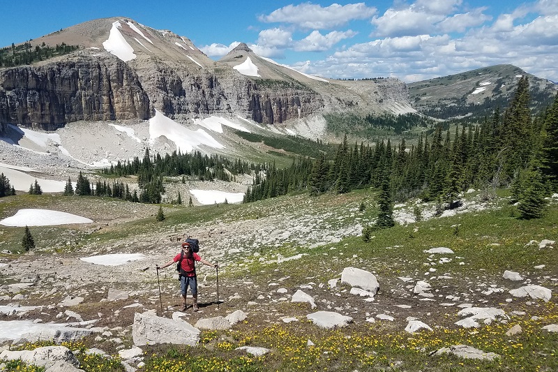
Day 2: Indian Point to Haystack Mountain (~8.5 miles)
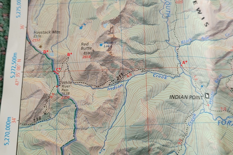
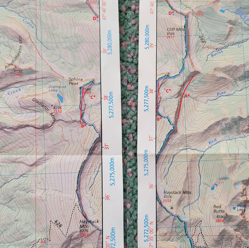
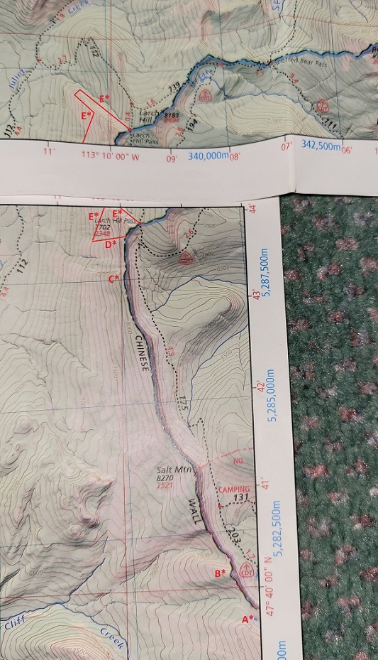
A* River crossing. B* A short unmarked spur trail to glimpse the Wall. C* Shortcut to the Wall. D* Cliff and scrambling.
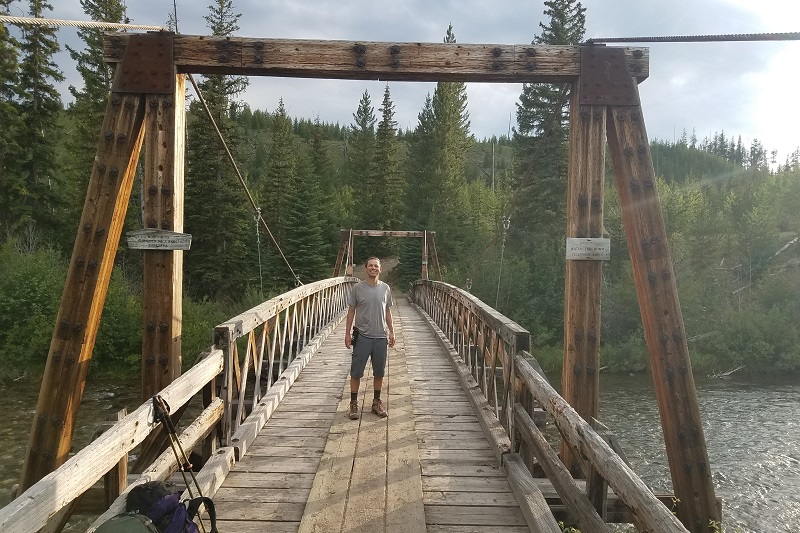
On Day 2, we hiked from Indian Point to Haystack Mountain. Immediately, you enter the trees and don’t come out until they get thinner as you ascend the canyon leading to White River Pass. You need to cross the South Fork of the Sun River. It helps to have hiking poles for stability when the water is high, and shoes you can get wet (A*).
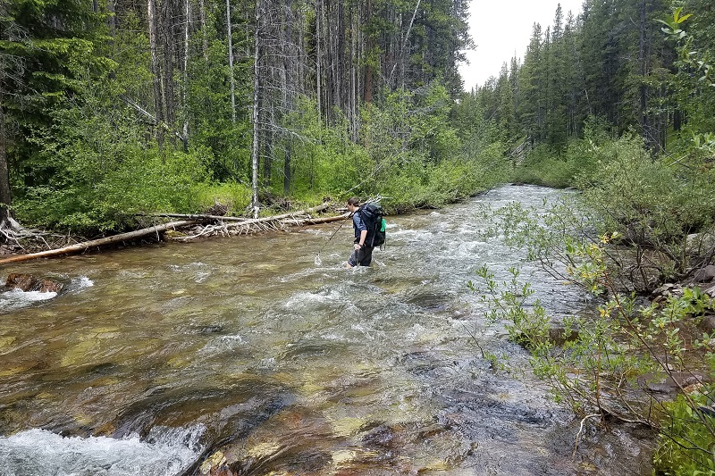 Crossing the river on July 2, 2020 (A*).
The trail to White River Pass is well-maintained and easy to follow. Before you reach White River Pass, you can cut northwest to the ridgeline and begin your ascent to the Wall (C*). Shortly before cutting off the trail, you need to fill up with water. There are streams of snowmelt high up the ridge, so you can wait until shortly before going off-trail to fill your water. If you are hiking after the snow melts (August most likely), fill up from Indian Creek. This will be your last water until the following afternoon. Most of the rest of the hike to Haystack Mountain is pretty steep. There are some small cliffs to scramble up, the first (D*) being the most intimidating.
 Cliff to access the Wall (D*). If hiking from above, there is a cairn on top. From the bottom, we climbed up the middle, and the cairn at the top was farther left.
Haystack Mountain is a fantastic spot to camp and watch the sunset. There are one or two flat spots dug out behind tree stands for protection from the wind. There is a trail ascending from the west primarily used by folks on horseback.
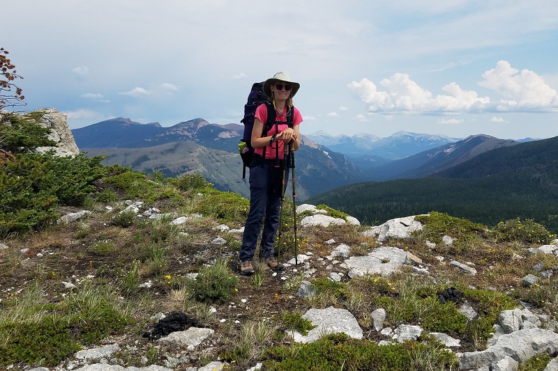
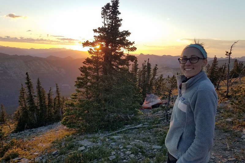 Our campsite just below Haystack Mountain
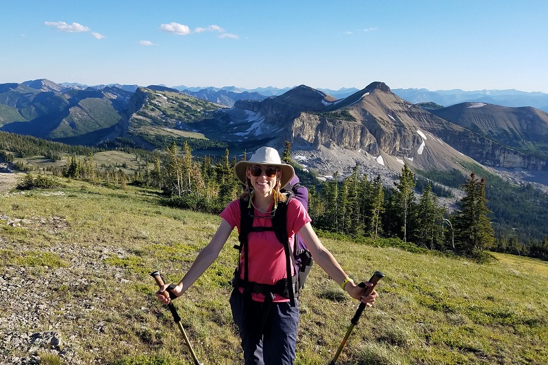
Day 3: Haystack Mountain to Cliff Mountain (~7 miles)
On Day 3, we watched the sunrise, ate a leisurely breakfast, and took lots of photos enjoying being on the Wall. We would make up for this with a grueling Day 4.
A* The Wall. B* Not the Wall. C* Water. D* Water for Day 4.
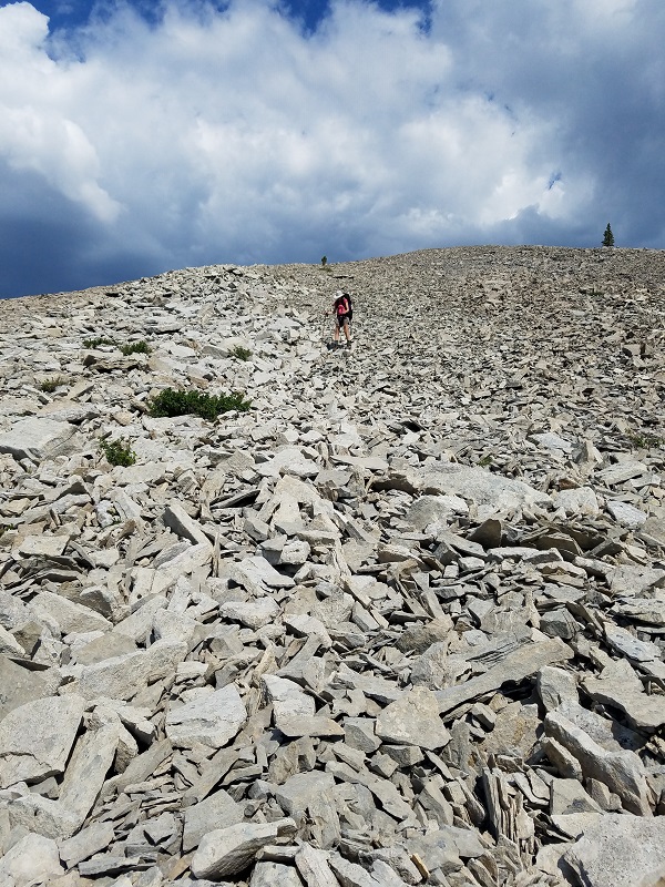
Shortly after Haystack, there is a rocky gulch of massive boulders. It is easy enough to navigate.
 Boulder field after Haystack Peak
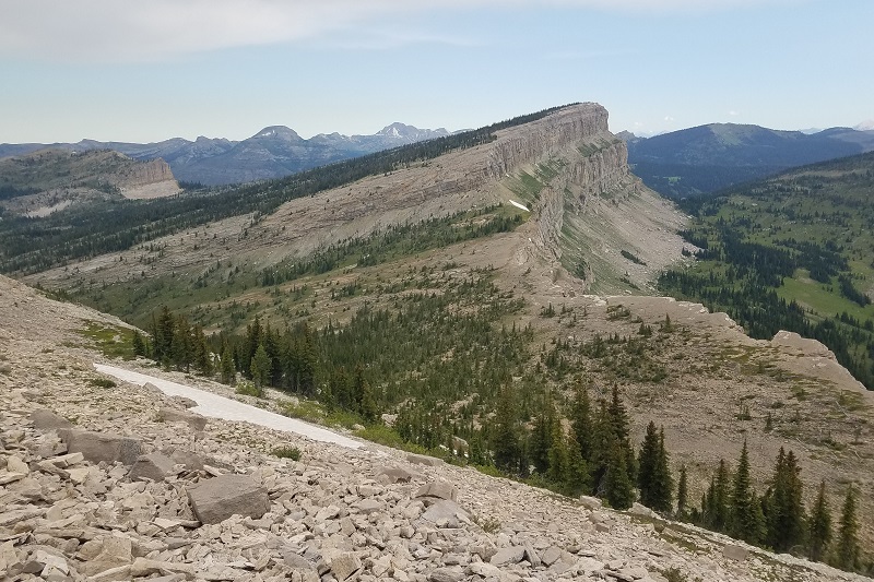
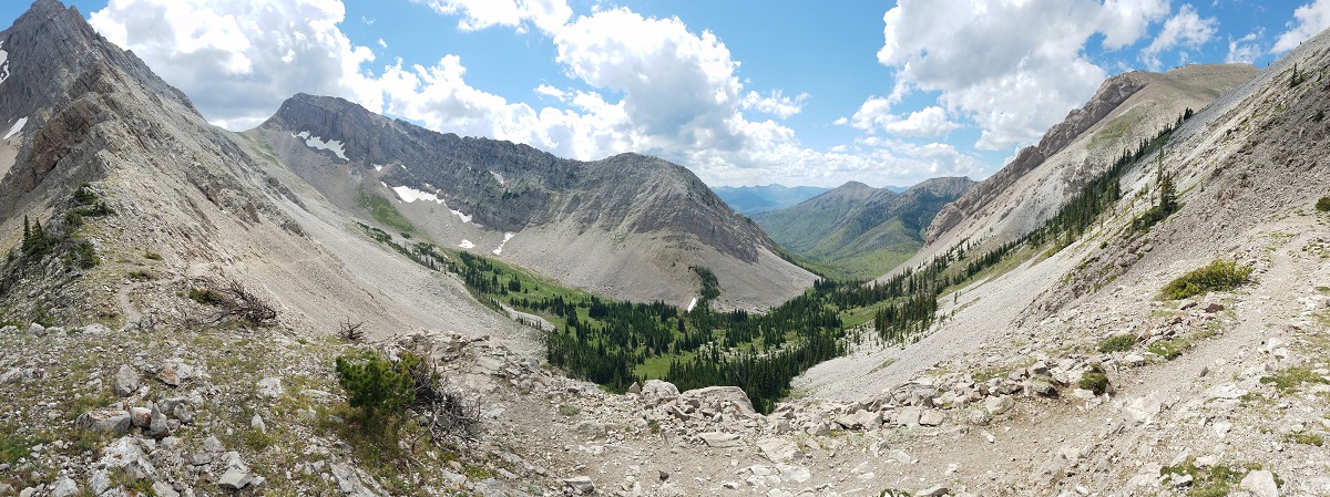
A couple of miles later, you will cross to the east of the Continental Divide (between the lines marked A* and B* on the map). The blue shading on my map marks the Continental Divide, which is usually the Wall. However, the Continental Divide jaunts west of the Wall, ascending to Sphinx Peak at the line marked B*. This threw off my orientation, as I mistakenly thought we were descending to Diamond Lake. Shortly after descending into this basin, there are creeks with water. At the point marked C*, there should be a pond. This is likely your last water until after Cliff Mountain.
 Descending into the basin east of Sphinx Peak (the pointy mountain in the center of the frame). Cliff Mountain is in the top right.
We ascended Cliff Mountain (the highest peak on the Wall) and spent the night there. The view is spectacular, with an ocean of uninterrupted mountains and wilderness in every direction. Traveling down the slope to hang the bear bag, we spotted a grizzly several hundred yards down the valley. The top of the mountain was windy at night and each rustle made us a little jumpy.
 Ascending to Cliff Mountain. The name for Sphinx Peak becomes obvious here.
Day 4: Cliff Mountain to My Lake (~13.5 miles with lots of descending and ascending)
Day 4 didn’t need to be so long, but I misjudged where we could cross the Wall at the end of the day and head toward My Lake. We hiked for about 12 hours and finished most of our seven liters of water before reaching a new water source. We ascended and descended many thousands of feet.
A* Last water source until creek before My Lake. B* Ridge requiring long descents. C* So close, but so far. D* Best route to cross Wall. E* Horrible route to cross Wall.
From the top of Cliff Mountain, you can see a pond at the base (A*). In the morning, we descended and filled up all of our water. We next encountered water in a mosquito-larvae filled puddle shortly before crossing Larch Pass. Even if you don’t follow our horrible route, the next water you should encounter is a creek shortly before My Lake, so you have a full day of hiking between water sources.
Shortly after leaving the pond, you encounter a large ridge (B*) requiring descending to circumnavigate or picking your way through dodgy cliffs. A common feature of this section is lengthy descents to the west to avoid cliffs. You frequently choose between how far out of the way and downhill you want to hike vs. how steep of a hillside are you willing to endure. The near side and the far side of the ridge (B*) can be navigated by sneaking through cliffs. The next ascent cannot and you’ll need to descend to the west before ascending again up Salt Mountain.
 Hiking the back side of the ridge (B*). Salt Mountain is the next ridge.
We ate lunch on Salt Mountain. The three miles from Salt Mountain to the next set of cliffs (C*) is wonderful. Mild inclines and declines immediately next to the Wall with great views. Once you reach the cliffs, you need to descend 1000 vertical feet of scree and sparse trees to get around.
 Larch Hill Pass felt so close at this point
 Descending scree from point C*.
 Losing 2/3 of your elevation from the Wall to the valley floor is kind of depressing
Once you get around the cliffs, continue hiking north until you identify the correct drainage so that you can ascend back up (D*). Based on the topographic map, I wasn’t sure if we could cross the Wall at D* and led us on a huge loop (E*) through the forest and another set of cliffs that required even more descending. By the time we crossed Larch Hill Pass, we were exhausted and short on water. The trail to My Lake travels underneath the more direct crossing. We could later see where we should have crossed.
Finally, we slogged the last 2.5 miles to My Lake. Covered in sweat, I tiptoed along a fallen tree and jumped into a foot of muddy water full of leeches.
 The fallen tree into My Lake.
Day 5: My Lake to North Fork of the Sun River (~14.5 miles)
We were happy to be back on a trail after the previous couple days of cliffs and questionable navigating. Most of the way from My Lake to the North Fork of the Sun River is in trees and somewhat boring. The last few miles starting at Red Shale Creek open up. We encountered half a dozen sets of mountain grouse families with chics. Sarah got charged by one.
There is a work camp just before the bridge with river access and camping spots.
Day 6: North Fork of the Sun River to South Fork Teton Trailhead (~11.5 miles)
By day 6, we were ready to be home and we booked it to Headquarters Pass (pushing through my insane blisters). The bowl just below the pass is idyllic.
 Headquarters Pass looking west
We did our route as a one-way with a friend shuttling our vehicle for us. To return to Benchmark from Larch Hill Pass, you could return south on the CDT and hike underneath the Wall and back to Indian Point. Alternatively, you could loop west, hike along the White River and back to the White River Pass.
Additional resources:
We knew this route was possible thanks to this blog post from Ear Mountain Photography.
For helpful visualization with video from Google Earth, see this Youtube video from Wilderness Mindset.
Pin this article for later!
The following two tabs change content below.


I am Sterling, one of the Two Fish Traveling. I love to travel and live in Polson, Montana with my wife Sarah.
Latest posts by Sterling Laudon (see all)
- How to Hike the Top of the Chinese Wall in the Bob Marshall Wilderness - March 28, 2023
- All of the bad things that happen when you travel - October 14, 2019
- Favorite countries of long-term travelers - August 8, 2019


Your map of Day 4 shows Camping (in red) below Salt Mtn, at the Moose Creek trail junction. I thought I read somewhere that camping wasn’t allowed along the central part of base of Wall. Do you know?
There is no camping on the east side of the Wall in the Moose Creek Drainage that runs from a ridge a bit north of Cliff Mountain up the a ridge below Salt Mountain. It’s a little hard to see the “No” on the map, but it’s marked as “No Camping” in red letters.